Safety 9 min read
How to Share Your Live Location While Hiking: A Safe Hike Plan
Realistic time estimates, a message for home with a clear call-for-help time, one live map link for family, a battery plan for a full day and what to expect when signal drops in a valley.
Published by BEON.RUN ·
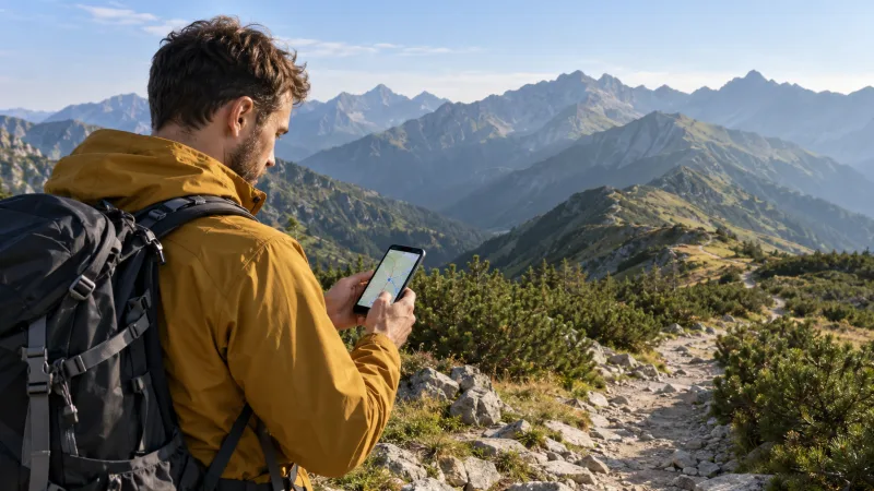
You leave the trailhead at dawn, you plan to be back before dark, and someone at home spends the day wondering whether "no reply" means a dead phone or a real problem. Hiking is often a full day out of contact, and in deep valleys the signal disappears without warning. A short plan before you go and one live map link can turn that worry into calm.
This guide is for hikers and trekkers, not trail runners. You will get a realistic way to estimate hiking time, a message template for home with a clear call-for-help time, how to share your live location, a battery plan for 8-10 hours and a packing list. If you run in the mountains, read the separate guide on trail and mountain runs with a live link.
Plan the hike before you share it
Your family can only help if they know what to expect, and that starts with your own plan. It does not need to be complicated, but it needs to exist somewhere other than your head.
Route and bail-out options
Pick the trail and study it on a map: trailhead, summit or destination, huts or shelters, passes, water sources and places where you can cut the hike short. Mark at least one bail-out route for each half of the hike. On a loop it may be a connector trail back to the road; on an out-and-back it is simply turning around.
Save the route as a GPX file. You can draw it in any mapping tool or download an existing track. The file is useful twice: for you on the trail and for your family, who can see where you are supposed to be.
A realistic time estimate, with ascent
The most common mistake is counting distance only. A classic rule of thumb is Naismith's rule: one hour for every 5 km (3 miles) plus one hour for every 600 m (about 2,000 ft) of ascent.
| Item | Example: a day hike in the mountains |
|---|---|
| Distance | 16 km (10 mi), about 3 h 10 min of walking |
| Total ascent | 900 m (about 3,000 ft), about 1 h 30 min |
| Moving time | about 4 h 40 min |
| Breaks (lunch, photos, views) | about 1 h 15 min |
| Estimated total | about 6 h |
The rule assumes a fit adult with a light pack on decent trails. With children, in heat or snow, on rocky or overgrown paths, add a clear buffer. The rule also ignores steep descents, which are often slower than people expect.
Turnaround time and daylight
Set a time when you turn back no matter where you are. Work backwards from sunset: sunset minus the time to return from your farthest point minus at least one hour of margin. In autumn the days get short quickly, and under trees it gets dark earlier than on open ground.
If you are not at the top by your turnaround time, you turn around. It is the simplest decision on the trail and one of the most effective.
Weather for the elevation, not the town
A forecast for the town at the trailhead says little about the ridge. Higher up it is usually colder and windier, and in summer afternoon thunderstorms are common in many mountain ranges. Check a mountain or point forecast for the elevation you will reach; in the US the National Weather Service offers point forecasts. Many national parks also post trail conditions and closures on their official websites, so check those too.
What to tell people at home
A live link is a bonus. The foundation is a message that tells someone what to do if things go wrong. Without it, your family does not know when worry should turn into a call to rescue services.
Send it in the morning, before you lose signal:
Start: Lake trailhead parking, 8:00. Route: up to the saddle, along the ridge to the summit, down the east trail. Live link: [link]. Turnaround time: 13:30. Back at the car: around 16:00. If you have not heard from me by 18:00 and the dot is not moving, call 911 and give them this route.
What to include:
- Where you start and where the car is parked (make and plate help rescuers).
- Your route, including the planned bail-out.
- Who is with you and how to reach them.
- Expected return and, separately, a call-for-help time: the moment your contact calls for help. Give yourself 1.5-2 hours of margin.
- Where you expect silence, for example "the canyon section may have no signal for an hour".
Agree that you always check in when you are back, even with one word. If you change the plan on the trail, send an update as soon as you have signal. The same habits are covered in the guide on safe solo running, and they work just as well on a hike.
How to share your live location with one link
Sending map screenshots every hour drains your battery and your attention. A better option is one link that shows your position as it updates. It should work in any browser, because not everyone at home will install a new app, and a friend may open it on a work computer.
A few settings worth doing before you leave:
- Visibility: unlisted. Activities are private by default. An unlisted link is visible only to the people you send it to.
- Privacy trim. If you start from your home or a rental cabin, hide the first and last 200, 500 or 1000 m.
- GPX route imported and checked on the map.
- Test at home. Send the link to a second phone or computer and make sure it opens.
How long a live session can run depends on your plan, so check the plan details before a full-day hike.
Your position updates every few seconds, and points with poor accuracy or unrealistic jumps are rejected, so the dot does not jump around the mountainside. Breaks do not add distance.
Phone signal in valleys: what to expect
Cell towers usually sit in towns and valleys, and the signal travels in straight lines. That creates a common paradox: on the ridge you have signal, while in the narrow valley below it you have none. Forested steep slopes often give a weak, unstable connection, and many large parks have wide areas with no coverage at all.
What does that mean for a live link? When signal drops, your family sees your last known position. In BEON.RUN, GPS points recorded while offline wait on the phone and are sent when the network returns, so the route fills in without a gap. Explain this before you go: a dot that stands still for an hour in a valley is not an emergency. The trigger is no contact after the call-for-help time.
In deep valleys and under cliffs GPS also sees fewer satellites and is less accurate, so the end-of-day distance may differ slightly from a friend's watch.
Battery for a full day
Sharing your location for 8-10 hours is a lot of work for a phone. It keeps searching for a network in valleys, cold reduces battery capacity, and in a browser the screen has to stay on. BEON.RUN keeps it awake, because a locked screen or switching to another app can pause GPS. Streaming with the camera uses the most battery and a lot of mobile data.
A plan for a long hike:
- Start at 100% and carry the phone in an inside pocket, not in a side mesh pocket in the wind.
- Map only, no camera. Turn video on briefly, for example at the summit.
- Dim the screen and close other apps.
- Power bank and a short cable in an easy-to-reach pocket. Top up during lunch.
- Keep a reserve for an emergency call. Pick a threshold, for example 30%, below which you stop sharing, text home "heading down, saving battery" and keep the rest for calling for help.
Airplane mode saves battery but switches off data, so your family stops seeing your position. It is an emergency option, not a normal setting. More tips in the guide on phone battery during long live sessions.
What to pack for a full-day hike
None of this is overkill. Every item matters the day a hike takes longer than planned.
- [ ] charged phone with the local emergency number saved
- [ ] power bank and cable
- [ ] paper map of the area, in case the phone dies
- [ ] headlamp, even if you plan to be back in daylight
- [ ] rain jacket and a warm layer: fleece, hat, gloves
- [ ] emergency blanket and a whistle
- [ ] first aid kit: blister plasters, elastic bandage, personal medication
- [ ] water (1.5-2 l per person in summer) and extra food
- [ ] broken-in shoes or boots with good grip
- [ ] ID and some cash
- [ ] sunscreen and sunglasses
Above the tree line there is no shade and no shelter from the wind, so sun and weather hit harder than in the valley.
When something goes wrong
BEON.RUN is not an emergency service. It does not send alerts and it will not call for help on your behalf. If someone is injured, you are lost and it is getting dark, or the weather turns dangerous, make the call yourself.
| Where | Number |
|---|---|
| Europe (EU-wide) | 112 |
| United States and Canada | 911 |
| United Kingdom | 999 or 112, ask for police, then mountain rescue |
In many mountain regions, mountain rescue teams are reached through the general emergency number. When you call, give your location (coordinates, trail name, last junction or sign), what happened, how many people are with you and what gear you have. Then save battery and stay where you are unless the rescuers tell you otherwise.
This is where a live link has real value: your family can pass on your last known position and the route you walked, not just "somewhere in the park".
Pre-hike checklist
- Route chosen, GPX saved, bail-out options marked
- Time estimate made with ascent and breaks
- Turnaround time set, sunset checked
- Forecast for the elevation and park conditions checked
- Message sent home: route, return time, call-for-help time
- Hiking activity, unlisted link, privacy trim set
- Phone charged, power bank packed, battery reserve agreed
- Emergency number saved in contacts
Want to try it first? Create a free account and take a short test hike nearby. You will check the link, the map and your battery before the big day in the mountains.
Frequently asked questions
How can I let my family track my hike in real time?
Send them one link that opens in any browser. In BEON.RUN you start a hiking activity on your phone, set it to unlisted and share the link. Your family sees your current position, the route walked so far, time and distance, and the planned route if you imported a GPX file. They do not need an account or an app.
How long will my hike take?
A classic rule of thumb is Naismith's rule: one hour for every 5 km (3 miles) plus one hour for every 600 m (about 2,000 ft) of ascent. Then add time for breaks. With children, a heavy pack, heat, snow or rough terrain, plan noticeably longer, and remember that steep descents are slow too.
What happens to live tracking when there is no phone signal?
Your family sees your last known position until the signal returns. In BEON.RUN, GPS points recorded while offline are buffered on the phone and sent when the connection comes back, so the route fills in without a gap. Agree in advance that a dot standing still for a while in a valley is not an emergency.
Is a live location link a replacement for calling emergency services?
No. BEON.RUN is not an emergency service and does not send alerts. It shows where you are, or where you were at the last connection. In an emergency, call 112 in Europe or 911 in the US and Canada. In the UK, call 999 or 112 and ask for the police, then mountain rescue.
Let your people follow your route live
Video, GPS map and pace in one link. Viewers need no app and no account.